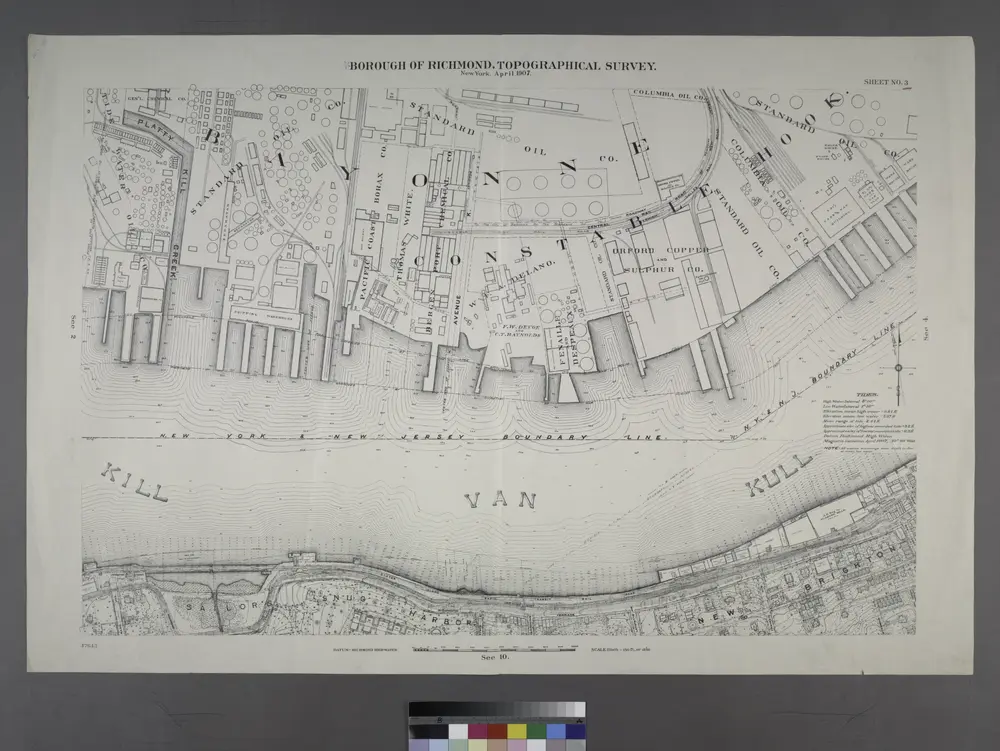
Borough of Richmond, Topographical Survey.
1913
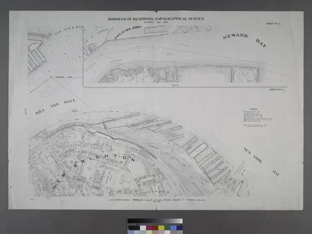
Borough of Richmond, Topographical Survey.
1913
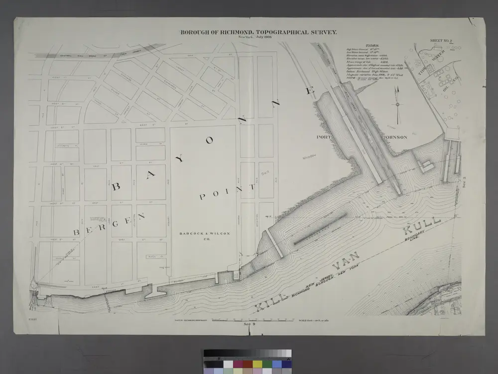
Sheet No. 2. [Includes Richmond Terrace in Staten Island, Port Johnson, New Jersey and Richmond Borough Boundary Line, and, Bayonne in New Jersey.]
1913
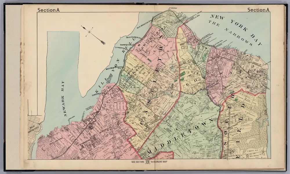
Section A (northern Staten Island, New York).
1887
Beers, J.B.
1:19k
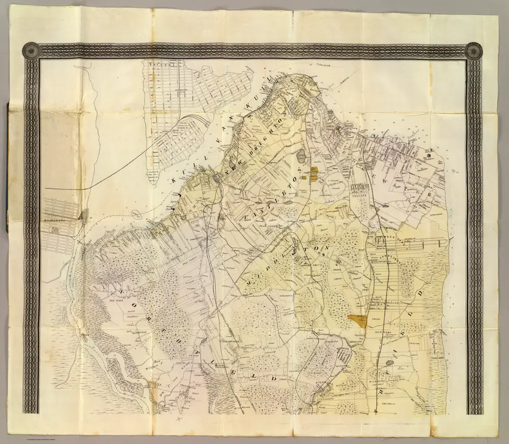
(Staten Island North)
1872
Dripps, Matthew
1:253k
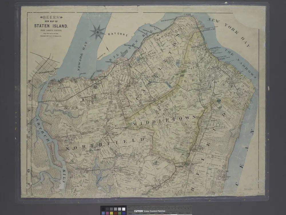
New map of Staten Island
1887
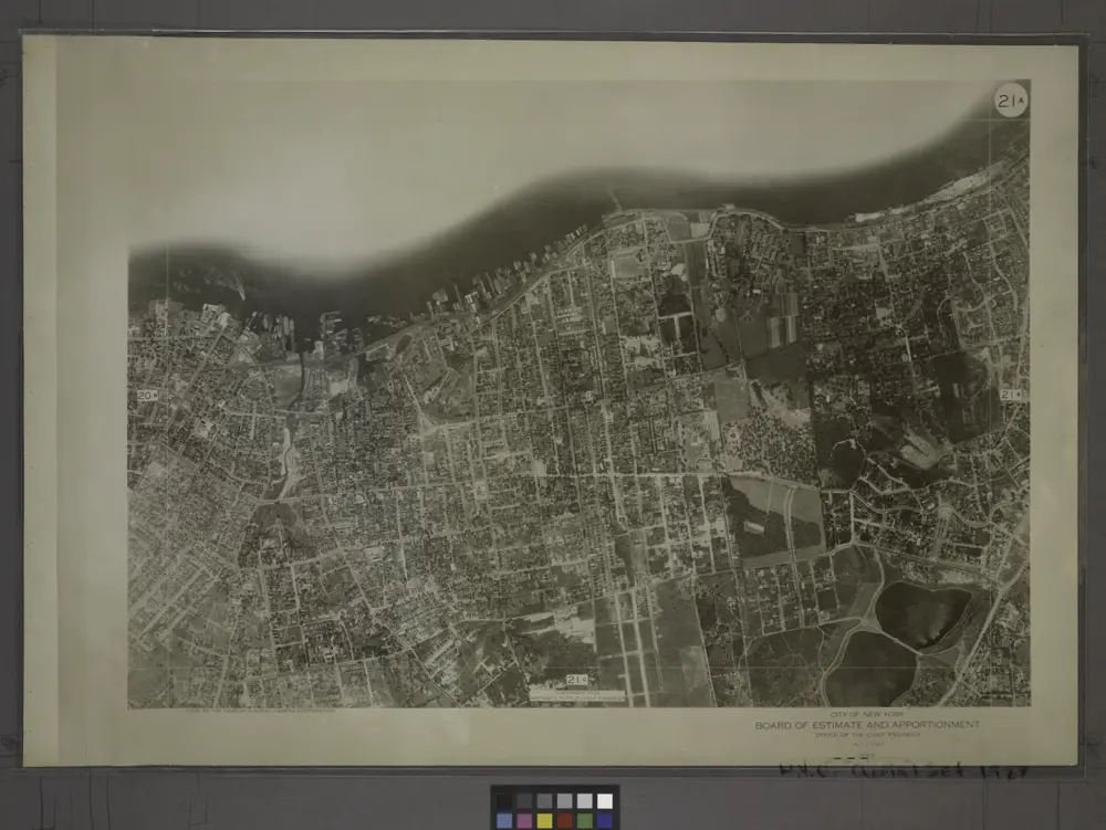
21A - N.Y. City (Aerial Set).
1924
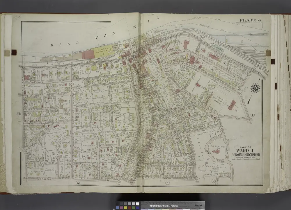
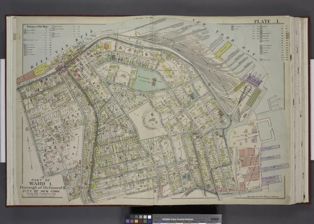
Part of Ward 1. [Map bound by Pierhead Line, Richmond Terrace, Nicholas St, St. Marks PL, Hamilton Ave, Daniel Low Terrace, Fort PL, Taft Ave (6th Ave), Jersey St, Pauw St (Center), York Ave, Prospect Ave, La Fayette Ave]
1917
Part of Ward 1. [Map bound by Kill Van Kull, Pier Head of 1889 & 1904, Arrietta St, First Ave, Westervelt Ave, Second Ave, York Ave, Eleventh St, Prospect Ave, Franklin Ave]
1907
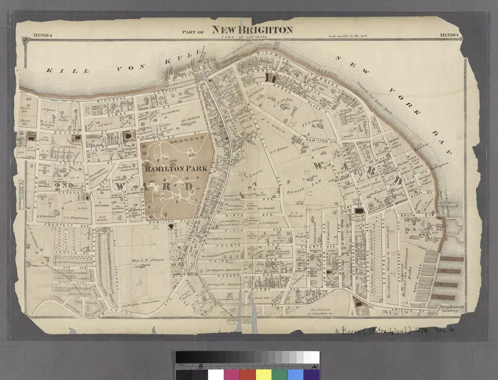
Part of New Brighton : Town of Castleton.
1874